The Palliser Expedition in the Canadian Rockies
 |
| The idea of this design concept is to use artworks to demonstrate names of places in the Canadian Rockies named for or by the Palliser Expedition and there are many! |
The Palliser Expedition is just one of the several sections in the new Gateway to the Rockies exhibition being developed by the Whyte Museum of the Canadian Rockies. We want your input and feedback on this permanent (ten year life) exhibition that we are planning to open at the Whyte Museum of the Canadian Rockies in the spring of 2012. Tell us what you think of this and the other concepts and stories featured here. Let us know how you think we could make this exhibition more interesting. Please keep in mind that this is a draft of the storyline, not the finished product. As the stories develop, information will be updated.
Hot on the heels of the fur trade came the inquiring minds of adventurers and scientific explorers assessing the land for natural resources and settlement. John Palliser and his men left their names on mountains, lakes, rivers and passes – Palliser, Hector, Bourgeau – and although he advised against it, Palliser’s report led to the settlement of the west.
In the nineteenth century, gentlemen of a certain attitude sought opportunities to embrace what was deemed adventure, and John Palliser was no exception. Globetrotter, bon vivant, and sports hunter, Palliser came from a wealthy Protestant Irish family with a history of military and public service. He gathered an education abroad, learning various languages, but although he enrolled in Trinity College in Dublin, did not complete a degree.
Determined to experience the ‘wilderness,’ he first went on a big game hunt in the Missouri territory in 1847-48, and that experience gave him a craving for further thrills. Determined to travel in the West, he proposed an expedition to the Royal Geographical Society to explore the southern prairies and the Rocky Mountain passes in the British territories. His suggestion had an advantage of timing. The HBC controlled the area, but it was clear that American expansion was creeping north and might try to claim Rupert’s Land. Palliser’s commission was to conduct scientific study in order to ascertain whether the West was habitable, accessible, and amenable to agricultural cultivation. David Thompson and Peter Fidler had already done this work, but the colonial office either chose to ignore their work or doubted the information that Thompson and Fidler provided.
Palliser and his party (which included a physician, geologist, botanist, astronomer, and magnetic observer) set out to explore the prairies, but did so with the help of Metis guides and local people. The expedition ultimately cost 13,000 pounds and took three years. It named many rivers and landmarks (both translating and replacing First Nations names) including the famous Mount Rundle, named by Palliser after Reverend Robert Rundle because he was impressed by Rundle’s influence on the First Nations people in the area. The expedition also provided a somewhat accurate “comprehensive” map, identified a fertile northern belt, and delineated areas that seemed suitable for settlement as well as the famous “Palliser’s Triangle” where Palliser asserted nothing would grow. For his efforts he was awarded the gold medal of the Royal Geographic Society a fine prize for a man who came, wrote a report, and then went on to his next adventure.
Excerpted from Mavericks Exhibition Manual, Aritha van Herk
 |
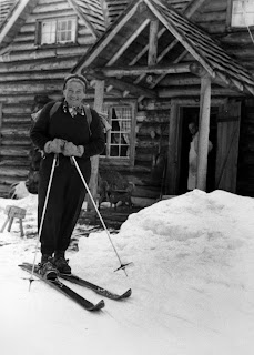
| Hector Lake [named after James Hector, a member of the Palliser expedition], Bow movie trip, 1914, Byron Harmon fonds (V263/NA 1858), Whyte Museum of the Canadian Rockies |


Comments
Post a Comment